Followers

Sunday, February 27, 2011

Winter cruising

Down below the cabin is warm. Almost too warm. The diesel heater is quietly at work, radiating heat throughout the boat. On deck it’s bitter cold. Down coats, layers, hats and gloves are needed to be comfortable.


The cockpit is between the two, alternating between almost too warm in the sun and just a little cool when the wind blows, finding small gaps in the cockpit enclosure.


This is our 2nd winter cruise and again the weather is just about perfect. Cold and clear.


After some initial problems with the house batteries and a self inflicted cooling problem, we spent 3 days in the islands, visiting Rosario and Deer Harbor with a brief stopover at West Sound.


The trip was sandwiched between 2 low pressure systems – the first bringing quite a bit of rain just before we left, the 2nd bringing what I hope is the season’s last snow a few days after we tucked the boat away.


With wind out of the North at over 20 knots, we motored out of Friday Harbor. This was our second departure of the day, the first departure curtailed by the high temperature alarm.


We took the longer scenic route over the top of Shaw island, and saw the new ‘over the top’ house on the south side of Bell and the lovely old red roofed house near neck point on Shaw. That’s the house I remember as a kid nearly 50 years ago signaling we were almost to San Juan Channel when we traveled westbound on the ferry.


Tom and Tessa had reported Killer Whales in Eastsound, but the morning’s engine fire drill had sufficiently delayed us so we didn’t see them. Tom and Tessa also had a chance for a workout and a hottub before we finally pulled into Rosario.


We shared the dock with only 3 other transient boats. In addition to Tom’s ‘Docktails’, there was a larger, poorly modified Hatteras and a Peterson 44 from Brisbane, Australia.


Monday, January 31, 2011

First Hike of the Year

Saturday dawned with gray and rain. We had hoped for better, but the drizzle became a driving rain by the time we started hiking. Si and Teneriffe disappeared into the clouds.


The trail starts on a logging road. That road continues on to a “Y” which can be used to get to Mount Si to the left or Mt Teneriffe to the right. The Kamikaze Falls trail branches off to the right after about a mile from the trail head. The route follows another, older logging road for roughly another mile until a new trail cuts sharply to the right and climbs towards the falls.


This was our first real outing of the year and we both were interested in how the walking and running would prepare us for hiking. We had not had any elevation gain to speak of in a couple of months, but Jodi has been running and taking long walks and I’ve been running and biking to work.


To our pleasant surprise, the 1,300 feet of vertical elevation seemed easy. It’s not a particularly tough trail, but still there was a lot of ‘up’ and the legs took the grade easily enough. Jodi even ran a little of it.


The trail kisses the stream in a couple of places then switchbacks veer away from it until the end when all of a sudden you are ‘there’. The falls rise vertically for well over 100 feet and the view is pretty cool.


A good start to the hiking year. January and the legs seem to be ready for more….


Rex (aka the ‘fur’) had a good outing as well. He too is getting back in shape and did well on the hike, but crashed on his bed when we got home. We then went to our new favorite pub – the ‘Noble Fir’ – leaving at home a very immobile ‘fur’.

Sunday, November 14, 2010

November Hiking


Wallace falls is a decent hike. Nice view of several falls, pleasant low level rainy day hike. Just enough elevation gain to get some blood pumping but admittedly well shy of a good workout. ‘Pleasant’ and ‘decent’ are probably better than ‘great’ or ‘outstanding’ but all in all an ok hike.


We hiked for roughly 6 miles and ended up at the Red Hook brewery for a late lunch. Nice day…..


Sunday, October 31, 2010

Middle Fork -- again!!

What a great hike. Ok, there’s no drop dead view and it’s too long. There’s mud, the trail is washed out in places and the road to get there is rough. Still, it’s a great hike. Why? The bridge, the river, the views of Mt Garfield and the trees. Old growth trees. Moss carpeting the forest floor. And now cairns. Forest art. And weird mushrooms.


It’s a good hike

Tuesday, October 19, 2010

Granite Mountain Grind

Moving takes time. We moved from Preston to Bellevue. Less than 15 miles apart, but what a difference! Preston is a small, laid back and largely forgotten town. Just the way folks from Preston like it. Bellevue isn’t Preston.


We lucked out. We found a small ‘cottage’ close to the water and a great trail system tying Bellevue together with Mercer Island and Factoria. Given a couple of hours, everything is within walking distance. At just under 3 miles, work is within running distance and last week marked the first week where I ran to work each day.


Since the Mount Adams trip, we’ve been hiking once up to Thorp Mountain, but then hit a 5 week dry spell without hiking. Granite Mountain was the first outing after the move.


The trail to Granite starts out on a trail we used several times before – the Pratt lake trail. We used this trail as the ending point for our ‘round Bandara’ trip as well as the overnight trip into Pratt lake. But after hiking only about 20 minutes we took the Granite Mountain cutoff and headed up.


The trail becomes a bit merciless as you climb and climb and climb. The nice part is you are in and out of the forest and the views keep on getting better and better.


On this fall day the colors were great above the 4000 foot level. What we didn’t know, but certainly found out on the way back, is that the color was provided by Huckleberry bushes full of Huckleberries. Wonderful eating!!!!


There was a magical meadow awash in colors with a small stream going through it. I looked a bit for campsites by following some trails, but couldn’t find one. I didn’t spend that much time looking and this is largely a day hike. Coming up here and star watching would be a lot of fun.


By the time we hit the ‘magic meadow’, we were getting tired. The hike is beautiful, but it’s a grind. At 4 miles, it’s the same length as Mount Si, but with 600 feet more elevation gain within that 4 miles. Up, up, up.


The lookout at the top is visible as you approach, but it’s almost a deterrent. You’re getting tired and this thing is still ‘way up there’. Finally we made it to the look out and had a great lunch with a great view.


The trip down was long and the cold beer in the cooler in the truck tasted pretty good. Zeke’s pizza finished off the day.

Monday, August 16, 2010

Mount Adams Weekend


Backpacking on Mount Adams was the goal for the weekend. Mount Adams is located roughly in the middle of nowhere and there are two main routes to get there. Head straight for the mountain on largely secondary, two lane roads or go longer route down I5 and then cut over east on 12. What do to. I picked the straight shot. It never entered my mind that we’d have to take BOTH routes to get to the mountain.


Getting out of work Friday early just didn’t pan out so we were set on a Saturday morning departure. We started a little later than we should have and ran into some traffic south of Puyallup. That gradually thinned out and we went through Eatonville, and swung south on highway 7. We had seen plenty of Mount Rainier, but hadn’t spied Mount Adams yet. We were getting a little tired of being in the car for so long when the traffic came to an unexpected dead stop. People getting out of their cars stopped. We couldn’t see the cause, but there was no traffic coming the other way and emergency vehicles were racing towards something, using the open wrong way lane.


After about 40 minutes we got the word that there was an accident involving the state patrol and the road would be closed for an additional 2 hours. Nuts. Backtrack, head west away from the mountain, hook into I5 and take the route I should have taken in the first place. It was a 70 mile detour.


Approaching Mount Adams by car isn’t like approaching Rainier. You never really see the mountain. The two lane road becomes a single lane paved road and that gives way to a single lane gravel road. For something like 30 miles. Finally, at about 3:30, we get to the trail head after an 8 hour drive. This better be worth it was my unspoken thought.


We really hadn’t seen much of the mountain and we headed out through the forest on a weirdly sandy trail. Then we broke out into a meadow with wild flowers. It was getting pretty. Then, around a bend, the mountain came into view as a backdrop to the meadow with wild flowers. Breathtaking and stunning.


After hiking about 3 miles the trail intersects the Pacific Crest Trail, then pushes on another mile to our goal. High Camp at 7000 feet. We gained something like 1000 feet in that last mile. With full packs, it’s a bit of a workout to get there, climbing through sand and shale on a very steep slope.


High camp is another wildflower strewn meadow with a small stream. There are clumps of stunted trees, none very tall, that conceal a few campsites scattered throughout the meadow. I saw a small out of place mini trail that disappeared into one clump of trees so we hopped over the stream to investigate and found an ideal, picture perfect spot to pitch the tent. The wind was howling at this point and there was some protection from the wind and a wide open view of the mountain and much of the state of Washington. Perfect.


We had a terrific meal and then the sunset show began. We had the best seat in the house for a stunning sunset.


The wind howled most of the night, but it wasn’t too bad in the tent. Morning dawned cool and while the low lands were getting 90 degree temperatures, it was a cool 53 outside the tent.


We walked around high camp in the morning, seeing a Marmot and a few Mountain Goats.


Mount Rainier was out for the trip down.


Jodi takes one more look at Mount Adams. We’ll be back….


Sunday, August 8, 2010

SEAFAIR WEEKEND

First weekend in 4 that we haven’t gone hiking!


We spent Saturday on the logboom. Up early, Tom’s driver (thanks Andy) picked us up at Leschi just before 7am in the Shamrock. We motored across the lake, under the I90 bridge and were on the logboom by 7:30 – just in time to be greated by a great breakfast (thanks Tessa!).


Bloody Marys followed breakfast and we settled into a gray, but very nice day on the boom.


Tom’s boat is the ideal seafair boat. Cockpit, covered bridgedeck, the top of the bridgedeck, flybridge, bow and salon are each nice areas to watch the festivities. 6 distinct and separate areas, each could hold a party, with only 7 of us on board. Comfortable and entirely civilized.


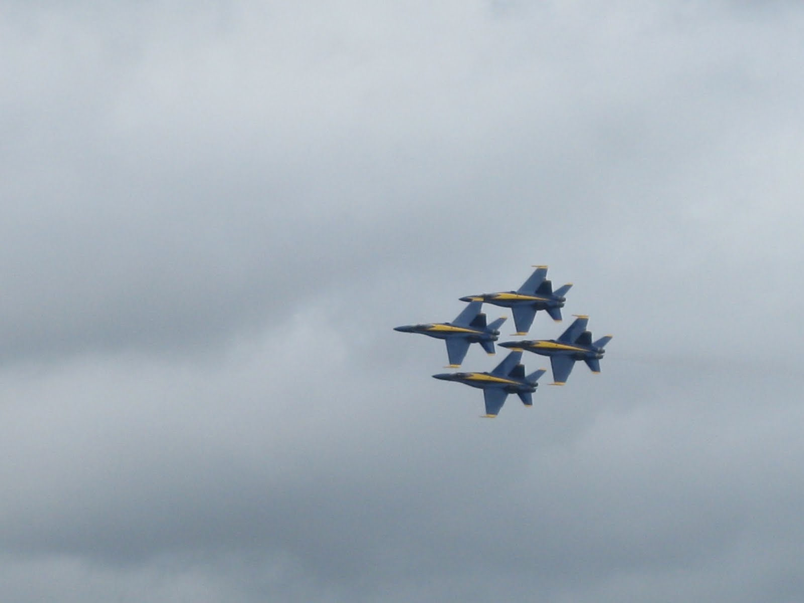
The highlight of the day had to be the F18. It did some high speed passes at just under the speed of sound. It looked like special effects from a movie, but the halo around the jet as it goes super sonic is amazingly cool. The blue angels were great, but the high speed passes of the f18 were jaw dropping.


Sunday was house cleaning day. Jodi did an amazing amount of work. I did a timed walk up Tiger Mountain in a vain attempt to wear out Rex and get some exercise.